Friday, December 31, 2010

Fog Blankets the State for the Last Hours of 2010

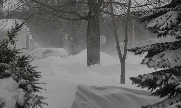
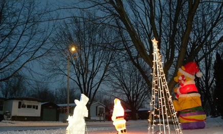
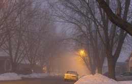
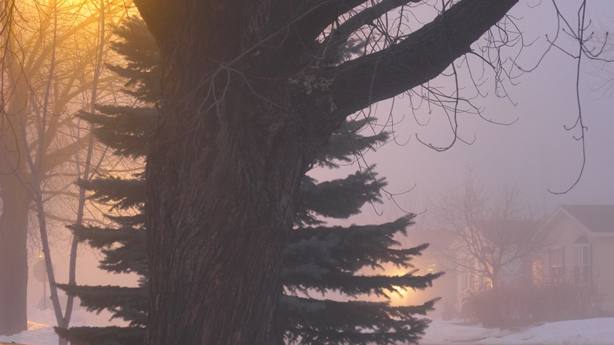
Foggy Evening Jan 31 2010 post top_1859Foggy Evening Jan 31 2010 post topCompressed   The last day of the year has Wisconsin blanketed in melting snow and fog. Foggy Evening Jan 31 2010 (2)_1856Foggy Evening Jan 31 2010 (2)Compressed Warm temperatures for western winds have a good portion of the snow here melting.

Statement as of 6:30 PM CST on December 31, 2010
Dense Fog Advisory
... Dense fog advisory remains in effect until 9 PM CST this
evening...
A dense fog advisory remains in effect until 9 PM CST this
evening.
* Areas of dense fog will continue into the early evening.
* Visibilities will be restricted to less than 1/4 mile at times.
* Motorists should be prepared for poor visibility in fog. 

Precautionary/preparedness actions... A dense fog advisory means visibilities will frequently be reduced to less than one quarter mile. When driving... be sure to slow down... use your low beam headlights... and keep a safe distance from other vehicles.
Statement as of 3:01 PM CST on December 31, 2010
Special Weather StatementFoggy Evening Jan 31 2010
... Slippery travel conditions expected to develop across the area... Travelers should prepare for scattered slippery travel conditions across north-central and portions of central Foggy Evening Jan 31 2010 (3)_1857Foggy Evening Jan 31 2010 (3)CompressedWisconsin late this afternoon and this evening. Hazardous travel conditions are likely across the entire region after midnight. A band of light precipitation will surge across the area this afternoon and early evening. Since temperatures across north-central and parts of central Wisconsin were around the freezing mark ... some of this precipitation will be in the form of light freezing rain.
At this time the amounts will be light but will still be capable of producing scattered slippery spots on untreated roads and sidewalks.  Temperatures across the entire area will turn sharply colder late this evening and in the hours after midnight. Although the precipitation is expected to have ended by then... the plunging temperatures are likely to cause lingering water on roadways to freeze into a sheet of ice... a situation known as a flash-freeze.
This could result in the rapid onset of treacherous travel conditions across the entire area. Anyone planning to drive home after a new year's eve party should be prepared to encounter icy roadways.  Foggy Evening Jan 31 2010 (1)
 

Winter Settles in Throughout Wisconsin.

Wisconsin is starting to settle in to winter.  Even I am starting to get used to it. 

Sunday, December 19, 2010

The Calm Before the Storm

Before the Storm top Dec 19  23_1608Before the Storm Dec 19  23Compressed.30hrs (1) Another round of winter weather is forecast for the Wisconsin and the upper Midwest.  Winter Weather Before the Storm Dec 19  23.30hrs Advisory remains in effect from 6 PM Monday to noon CST Tuesday... A Winter Weather Advisory for snow remains in effect from 6 PM Monday to noon CST Tuesday. * Snow is expected to develop across the region early Monday  evening... and continue into Tuesday morning.  Accumulations of 3 to 5 inches are expected. Some freezing drizzle is also possible on Tuesday.  The snow will produce hazardous travel conditions cross the region on Monday night and Tuesday morning.   Precautionary/preparedness actions... Before the Storm Dec 19  23.30hrs (1)A Winter Weather Advisory for snow means that periods of snow will cause some travel difficulties. Be prepared for snow covered roads and limited visibilities... and use caution while driving. The latest Wisconsin Road conditions can be obtained by calling 511.

Forecast For Brown County, WI …

Monday...Increasing clouds. A chance of light snow in the afternoon. Highs 23 to 28. Light and variable wind...becoming southeast at 5 to 10 mph in the afternoon. Chance of snow 30 percent.
Monday Night...Snow. 2 to 4 inches of accumulation expected. Nearly steady temperatures in the middle 20s. East wind 5 to 10 mph. Chance of snow 90 percent.
Tuesday...Cloudy. Light snow likely and a chance of freezing drizzle in the morning...then a chance of freezing drizzle and light snow in the afternoon. An inch or less of additional accumulation expected. Highs in the lower 30s. East wind 5 to 10 mph. Chance of precipitation 70 percent.

Tuesday, December 14, 2010

Subscribe to Phosari, all Marcel Kuemmet produced videos

At Phosari, the video arm of Wisconsin Confidential, imageGreen Bay Confidential and Marcel Kuemmet Photography, we try to provide information and interesting stories and video content from Green Bay, Bellevue and all of NE Wisconsin.  I simply try to make them interesting to watch.

If you would like to never miss an episode of Phosari, I recommend using Itunes to subscibe to my video podcast.  Subscribe to Phosari, my show, in High Def with any RSS use this link ... http://feeds.feedburner.com/PhosariHD

If you would like to subscribe using Itunes, use this link .. itpc://feeds.feedburner.com/PhosariHD

If you would like compressed smaller versions of the show, use this link.  … http://Marcel_Kuemmet.blip.tv/rss/itunes/

Sunday, December 12, 2010

Winter Arrives in full force in Wisconsin

Snow storm Top for posting Dec 12 2010 (4) Every apparatus known to man to be of value in the battle with the frost was employed today in the War with Old Man Winter.  Winter arrived with a strong front carrying high winds, cold temperatures and snow.Snow storm Dec 12 2010 (8)_1543Snow storm Dec 12 2010 (8)Compressed  In this case it seems to be the wind and blowing snow creating blizzard like conditions in Wisconsin and throughout the upper Midwest.   The front continues moving east as it’s effects could increasingly be felt nearing the east coast.

Snow drifts as high as 4 feet were encountered here, with high winds and drifting making travel difficult. It did appear that most of the roads in our area were mostly free from extremely high snow and contain only occasional drifts. One can see that travel in smaller vehicles could become difficult in some areas. With high winds and lots of fresh light snow, some roads could refill with snow within minutes of being cleared.  As the amount of snow was not the overriding issue, the wind and dropping temperatures are now the current weather concern.

The current weather forecast calls for dropping temperatures here in Wisconsin, with gusts of wind of up to 40 mph here in Bellevue.  Although the Sun will be shining at time, it will feel cold with temperatures in the teens. 

Here is the current forecast for Green Bay and NE Wisconsin from the National Weather Service;

Overnight: Areas of blowing snow. Partly cloudy, with a low around 5. Wind chill values between -10 and -15. North northwest wind between 20 and 24 mph, with gusts as high as 33 mph.
Monday: Sunny, with a high near 12. Wind chill values between -5 and -15. North northwest wind between 14 and 23 mph, with gusts as high as 30 mph.
Monday Night: Mostly clear, with a low around -2. Wind chill values between -15 and -20. North Snow storm Dec 12 2010 (5)_1540Snow storm Dec 12 2010 (5)Compressednorthwest wind between 9 and 13 mph, with gusts as high as 20 mph.
Tuesday: Sunny, with a high near 14. Wind chill values between -10 and -20. Northwest wind between 6 and 9 mph.
Tuesday Night: Partly cloudy, with a low around 0. West wind between 5 and 7 mph.
Wednesday: Mostly sunny, with a high near 18.
Wednesday Night: A 10 percent chance of snow. Partly cloudy, with a low around 3.
Thursday: A 20 percent chance of snow. Partly sunny, with a high near 23.DSCN0019_1569DSCN0019Compressed
Thursday Night: A slight chance of snow. Mostly cloudy, with a low around 13.
Friday: A slight chance of snow. Partly sunny, with a high near 25.
Friday Night: Mostly cloudy, with a low around 12.

Be sure to check back here for updates and for breaking Wisconsin, Green Bay, or Bellevue news.  Your only High Definition News source in NE Wisconsin.

Winter Storm Hits NE Wisconsin

Severe winter weather hit Green Bay with Blizzard like conditions at around 7:15 pm tonight. 

I was working on wrapping up an earlier report as the weather quickly changed.  Before I could upload the first report, it was snowing heavily already here. Below the earlier report is an updated one with more current conditions.

Here is the forecast from the National Weather Service …

Blizzard Warning
Special Weather Statement
Hazardous Weather Outlook
Overnight: Snow and widespread blowing snow. The snow could be heavy at times. Low around 21. North northeast wind between 32 and 34 mph, with gusts as high as 43 mph. Chance of precipitation is 100%. Total nighttime snow accumulation of around 10 inches.
Sunday: Widespread blowing snow and a chance of snow before noon, then a chance for flurries. Mostly cloudy, with a temperature falling to
around 15 by 5pm. North wind between
28 and 33 mph, with gusts as high as 46 mph. Chance of precipitation is 60%. New snow accumulation of less

than 1 inch possible.
Sunday Night: Areas of blowing snow. Mostly cloudy, with a low around 1. Wind chill values between -10 and -20. North northwest wind between 23 and 25 mph, with gusts as high as 41 mph.
Monday: Mostly sunny, with a high near 12. Wind chill values between -10 and -20. North northwest wind between 17 and 23 mph, with gusts as high as 30 mph.
Monday Night: Mostly clear, with a low around -1. North northwest wind between 9 and 16 mph, with gusts as high as 24 mph.
Tuesday: Sunny, with a high near 13.

Friday, December 10, 2010

Winter Storm Heads for Wisconsin

First Snow dec 10 top The first major winter storm is heading for Wisconsin and will arrive overnight.  Snowfall amounts of 10-18 inches are expected with blowing snow and drifting.  Here is the forecast and warning from the National Weather Service.
Tonight: A 30 percent chance of snow after midnight. Mostly

cloudy, with a temperature rising to around 27 by 5am. West wind at 11 mph becoming east.
Saturday: A chance of snow, freezing rain, and sleet before 9am, then snow likely, possibly mixed with rain, freezing rain, and sleet between 9am and 1pm, then snow after 1pm. The snow could be heavy at times. High near 34. North northwest wind between 6 and 14 mph, with gusts as high as 21 mph. Chance of precipitation is 100%. Little or no ice accumulation expected. New snow and sleet accumulation of around 5 inches.
Saturday Night: Snow and areas of blowing snow before midnight, then snow likely and widespread blowing snow after midnight. Low around 17. North northeast wind 9 to 12 mph increasing to between 25 and 28 mph. Winds could gust as high as 37 mph. Chance of precipitation is 100%. New snow accumulation of around 5 inches.
Sunday: Widespread blowing snow and a chance of snow before noon, then areas of blowing snow and a slight chance of snow after noon. Mostly cloudy, with a high near 18. North northwest wind between 26 and 30 mph, with gusts imageas high as 43 mph. Chance of precipitation is 40%. 
Sunday Night: Areas of bloDSCN8206_1475DSCN8206Compressedwing
snow. Partly cloudy, with a low around 6. North northwest wind between 17 and 25 mph, with gusts as high as 36 mph.

URGENT - WINTER WEATHER MESSAGE NATIONAL WEATHER SERVICE GREEN BAY WI 257 PM CST FRI DEC 10 2010 ...MAJOR WINTER STORM THIS WEEKEND... .A VERY STRONG WINTER STORM WILL BRING HEAVY SNOW...BLOWING AND DRIFTING SNOW...NEAR BLIZZARD CONDITIONS AND BITTERLY COLD TEMPERATURES TO THE REGION THIS WEEKEND. AN AREA OF LOW PRESSURE WILL INTENSIFY AS IT MOVES OVER NORTHERN IOWA AND EXTREME SOUTHERN WISCONSIN ON SATURDAY...AND INTO LOWER MICHIGAN ON SUNDAY. AHEAD OF THIS LOW PRESSURE SYSTEM...SNOW WILL BEGIN TO PUSH INTO CENTRAL WISCONSIN LATE TONIGHT BEFORE INTENSIFYING AND SPREADING ACROSS THE REST OF NORTHEAST WISCONSIN ON SATURDAY. MODERATE TO HEAVY SNOW IS EXPECTED TO CONTINUE INTO SATURDAY EVENING...THEN WIND DOWN AFTER MIDNIGHT. IN ADDITION...GUSTY NORTH WINDS WILL DEVELOP BEHIND THE LOW AND GENERATE BLOWING AND DRIFTING CONDITIONS. WINDS MAY BECOME STRONG ENOUGH TO PRODUCE NEAR BLIZZARD CONDITIONS SATURDAY NIGHT INTO SUNDAY FOR MAINLY NORTHEAST WISCONSIN. WIZ005-010>012-018-019-030-035>037-045-110500- /O.CON.KGRB.WS.W.0003.101211T0600Z-101212T1800Z/ VILAS-ONEIDA-FOREST-FLORENCE-LINCOLN-LANGLADE-MARATHON-WOOD- PORTAGE-WAUPACA-WAUSHARA- INCLUDING THE CITIES OF...EAGLE RIVER...RHINELANDER...CRANDON... TOMAHAWK...ANTIGO...WAUSAU...WISCONSIN RAPIDS...STEVENS POINT... WAUTOMA 257 PM CST FRI DEC 10 2010 ...WINTER STORM WARNING REMAINS IN EFFECT FROM MIDNIGHT TONIGHT TO NOON CST SUNDAY... A WINTER STORM WARNING REMAINS IN EFFECT FROM MIDNIGHT TONIGHT TO NOON CST SUNDAY. * SNOW WILL BEGIN TO OVERSPREAD CENTRAL WISCONSIN LATE TONIGHT AND REACH EASTERN WISCONSIN SATURDAY MORNING. THE HEAVIEST PERIOD OF SNOWFALL WILL OCCUR ON SATURDAY. * SNOW ACCUMULATIONS ARE FORECAST TO RANGE FROM 10 TO 16 INCHES BY SATURDAY NIGHT WITH CONSIDERABLE BLOWING AND DRIFTING SNOW. * TRAVEL CONDITIONS WILL BECOME EXTREMELY HAZARDOUS SATURDAY INTO SATURDAY NIGHT AS A RESULT OF THE HEAVY SNOW...AND REDUCED VISIBILITIES FROM THE BLOWING AND DRIFTING SNOW. PRECAUTIONARY/PREPAREDNESS ACTIONS... A WINTER STORM WARNING FOR HEAVY SNOW AND BLOWING SNOW MEANS SEVERE WINTER WEATHER CONDITIONS ARE EXPECTED OR OCCURRING. THE COMBINATION OF SNOW AND STRONG WINDS WILL MAKE TRAVEL VERY DIFFICULT. IF YOU MUST TRAVEL...KEEP AN EXTRA FLASHLIGHT...FOOD... AND WATER IN YOUR VEHICLE IN CASE OF AN EMERGENCY. THE LATEST WISCONSIN ROAD CONDITIONS CAN BE OBTAINED BY CALLING 511.

Thursday, December 9, 2010

Wisconsin Gets Significant Snowfall

Snowfall Dec 9 2010 top for post Wisconsin received a significant snowfall of 2010 today.  According to the National Weather Service;  A BAND OF LIGHT TO MODERATE SNOW

CONTINUES TO PUSH FROM WEST TO EAST ACROSS THE FORECAST AREA THIS EVENING. THE SNOW WILL BEGIN TO TAPER OFF TO FLURRIES FROM WEST TO EAST THIS EVENING & COULD BRIEFLY CHANGE TO SOME LIGHT FREEZING DRIZZLE BEFORE ENDING BY MIDNIGHT. AFTER A PERIOD OF QUIET WEATHER ON FRIDAY.AN AREA OF LOW PRESSURE WILL INTENSIFY AS IT OVES OVER IA & NORTHERN IL ON SAT & INTO LWR MI ON SUNDAY. AHEAD OF THIS LOW PRESSURE SYSTEM.SNOW WILL BEGIN TO PUSH INTO CNTL WI SAT MORNING BEFORE INTENSIFYING & SPREADING ACROSS NE WI SAT AFTERNOON. MODERATE TO HEAVY SNOW IS EXPECTED TO CONTINUE SAT AFTERNOON INTO THE SATURDAY EVENING.THEN WIND DOWN AFTER MIDNIGHT. IN ADDITION.GUSTY NO. WINDS WILL DEVELOP BEHIND THE LOW AND GENERATE BLOWING & DRIFTING CONDITIONS. SOME UNCERTAINTY EXISTS WITH THE TRACK & STRENGTH OF THE LOW PRESSURE  Snowfall Dec 9 2010 (3)_1465Snowfall Dec 9 2010 (3)Compressed SYSTEM.SO SOME ADJUSTMENTS TO SNOWFALL ACCUMULATIONS ARE POSSIBLE AS THE EVENT DRAWS CLOSER.


.WINTER WEATHER ADVISORY REMAINS IN EFFECT UNTIL MIDNIGHT CST TONIGHT.
.WINTER STORM WATCH IN EFFECT FROM SAT MORNING THROUGH LATE SAT NIGHT.

THE NATL WEATHER SVC IN GREEN BAY HAS ISSUED A WINTER STORM WATCH.WHICH IS IN EFFECT FROM SAT MORNING THROUGH LATE SAT NIGHT. A WINTER WEATHER ADVISORY REMAINS IN EFFECT UNTIL MIDNIGHT CST TONIGHT. Snowfall Dec 9 2010 (5)_1467Snowfall Dec 9 2010 (5)Compressed

* LIGHT SNOW WILL CONTINUE TO AFFECT THE AREA THROUGH EARLY
EVENING.THEN DIMINISH TO FLURRIES.

FOR THE LOW PRESSURE SYSTEM ARRIVING ON SATURDAY.SNOW WILL  ARRIVE EARLY SAT MORNING OVER CNTL WI. THE  HEAVIEST PERIOD OF SNOWFALL WILL OCCUR LATE SAT MORNING THROUGH SAT AFTERNOON.

* TOTAL SNOWFALL ACCUMULATIONS WILL RANGE FROM 1 TO 3 INCHES.  LOOK FOR SOME FREEZING DRIZZLE TO DEVELOP EARLY THIS EVENING AS  THE SNOW BEGINS TO DIMINISH TO FLURRIES.

AN ADDITIONAL 5 Snowfall Dec 9 2010 (1)_1463Snowfall Dec 9 2010 (1)CompressedTO 10 INCHES OF SNOW IS POSSIBLE WITH THE SECOND  STORM DUE TO MOVE OVER THE AREA SAT & SAT NIGHT.
 
* ROADS WILL REMAIN SNOW COVERED & SLIPPERY MAKING TRAVEL  DIFFICULT THIS EVENING. TRAVEL CONDITIONS WILL BECOME EXTREMELY HAZARDOUS SAT INTO  SAT NIGHT AS A RESULT OF THE HEAVY SNOW.& REDUCED VISIBILITIES FROM THE BLOWING & DRIFTING SNOW.


Wednesday, December 1, 2010

NE Wisconsin Gets First Measurable Snowfall

  First Snow Dec 1 top Here in Bellevue, Wisconsin the first of what is sure to be many snowfalls fell today.First Snow Dec 1 2010 (7)_1290First Snow Dec 1 2010 (7)compressed  With the rest of today remain mostly cloudy into the evening then becoming partly cloudy.  Scattered flurries are predicted for early in the evening with the Lows 15 to 18. West winds of 10 to 15 mph.  First Snow Dec 1 2010 (16)_1299First Snow Dec 1 2010 (16)compressed

First Snow Dec 1 2010 (5)


First Snow Dec 1 2010 (2)_1285First Snow Dec 1 2010 (2)compressed First Snow Dec 1 2010 (24)_1307First Snow Dec 1 2010 (24)compressed

First Snow Dec 1 2010 (22)_1305First Snow Dec 1 2010 (22)compressed

First Snow Dec 1 2010 (18)_1301First Snow Dec 1 2010 (18)compressed

First Snow Dec 1 2010 (13)_1296First Snow Dec 1 2010 (13)compressed

First Snow Dec 1 2010 (3)_1286First Snow Dec 1 2010 (3)compressed

Tuesday, October 26, 2010

Midwest Wind Storm strong, but no Cyclone in Wisconsin

Dscn7616 top There have been tornado touchdowns, power outages in Door as well as other counties, and a second day of the same on the way.

Here are the warnings currently

Your CURRENT SEVERE Weather RADAR MAP Link...http://www.emergencyemail.org/weathergetWANG1.asp?src=DS.p19r0/si.kGRBSEVERE WEATHER ALERT LINKhttp://www.EmergencyEmail.org/wxl/WI/wxl55009-60427.55.aspYOUR LOCAL FORECASThttp://www.Emergencyemail.org/wx/us/WI/55009.asp.VERY WINDY CONDITIONS CONTINUE

TONIGHT & WEDNESDAY..AN INTENSE STORM SYSTEM LOCATED OVER NO. CNTL MN ISFORECAST TO SLOWLY MOVE INTO EXTREME SW ONTARIO TONIGHT.THE WINDS ARE EXPECTED TO SUBSIDE A BIT LATER THIS EVENING AND OVERNIGHT.& THEN INCREASE ONCE AGAIN ON WEDNESDAY. SUSTAINEDWINDS OF 25 TO 40 MPH WITH GUSTS TO 60 MPH ARE EXPECTED ACROSS THECNTL & EAST ON WEDNESDAY. SUSTAINED WINDS OF 20 TO 30 MPHWITH GUSTS TO 45 MPH ARE EXPECTED ACROSS THE NO. ON WEDNESDAY.WIZ020>022-030-031-035>040-045-048>050-073-074-270430- /O.CON.KGRB.HW.W.0002.000000T0000Z-101028T0000Z/MENOMINEE-NORTHERN OCONTO-DOOR-MARATHON-SHAWANO-WOOD-PORTAGE- WAUPACA-OUTAGAMIE-BROWN-KEWAUNEE-WAUSHARA-WINNEBAGO-CALUMET-MANITOWOC-SOUTHERN MARINETTE-SOUTHERN OCONTO-INCLUDING THE CITIES OF.KESHENA.STURGEON BAY.WAUSAU.WI RAPIDS.STEVENS POINT.APPLETON.GREEN BAY.ALGOMA.WAUTOMA.OSHKOSH.CHILTON.TWO RIVERS.CRIVITZ341 PM CDT TUE OCT 26 2010.HIGH WIND WARNING REMAINS IN EFFECT UNTIL 7 PM CDT WEDNESDAY.A HIGH WIND WARNING REMAINS IN EFFECT UNTIL 7 PM CDT WEDNESDAY.* VERY WINDY CONDITIONS WILL CONTINUE DSCN7617_1060DSCN7617compressedTHIS EVENING BEFORE DIMINISHING A BIT OVERNIGHT. THE VERY WINDY CONDITIONS WILL DEVELOP ONCE AGAIN ON WEDNESDAY.* SW WINDS OF 25 TO 40 MPH ARE EXPECTED INTO EARLY EVENING BEFORE DECREASING TO 20 TO 30 MPH. POTENTIAL GUSTS AS HIGH AS 55 TO 60 MPH ARE POSSIBLE INTO EARLY EVENING & THEN DIMINISH TO 40 TO 45 MPH OVERNIGHT. WEST WINDS ARE FORECAST TO INCREASE INTO THE 25 TO 40 MPH RANGE WITH GUSTS UP TO 60 MPH ON WEDNESDAY.DSCN7612_1055DSCN7612compressed* WINDS AS STRONG AS FORECAST CAN LEAD TO DOWNED TREES. TREES FALLING ON POWER LINES CAN CAUSE POWER OUTAGES. DRIVING. ESPECIALLY HIGH PROFILE VEHICLES.WILL BE HAZARDOUS. LOOSE OUTDOOR OBJECTS ALSO WILL BE BLOWN AROUND BY THESE STRONG WINDS.PRECAUTIONARY/PREPAREDNESS ACTIONS.A HIGH WIND WARNING MEANS A HAZARDOUS HIGH WIND EVENT IS EXPECTEDOR OCCURRING. SUSTAINED WIND SPEEDS OF AT LEAST 40 MPH OR GUSTSNEAR 60 MPH OR MORE CAN LEAD TO PROPERTY DAMAGE. TREE BRANCHESAND POWER LINES CAN COME DOWN IN WINDS THESE STRONG. HIGH PROFILEVEHICLES WILL BE DIFFICULT TO DRIVE IN THESE CONDITIONS.&&$$ WIZ005-010>013-018-019-270430-/O.CON.KGRB.WI.Y.0006.000000T0000Z-101028T0000Z/VILAS-ONEIDA-FOREST- FLORENCE-NORTHERN MARINETTE-LINCOLN-LANGLADE-INCLUDING THE CITIES OF.EAGLE RIVER.RHINELANDER.CRANDON. TOMAHAWK.ANTIGO341 PM CDT TUE OCT 26 2010.WIND ADVISORY REMAINS IN EFFECT UNTIL 7 PM CDT WEDNESDAY.A WIND ADVISORY REMAINS IN EFFECT UNTIL 7 PM CDT WEDNESDAY.* WINDY CONDITIONS WILL CONTINUE INTO EARLY EVENING BEFORE DIMINISHING A BIT OVERNIGHT. THE WINDY DSCN7610_1053DSCN7610compressedCONDITIONS ARE EXPECTED TO RETURN ON WEDNESDAY.* SW WINDS OF 20 TO 30 MPH WILL CONTINUE TONIGHT. POTENTIAL GUSTS AS HIGH AS 45 MPH ARE POSSIBLE INTO EARLY EVENING & THEN DIMINISH TO 30 TO 35 MPH OVERNIGHT. WEST WINDS ARE FORECAST TO PERSIST IN THE 20 TO 30 MPH RANGE ON WED WITH GUSTS TO AROUND 45 MPH.* WINDS AS STRONG AS FORECAST CAN LEAD TO DOWNED TREES. TREES FALLING ON POWER LINES CAN CAUSE POWER OUTAGES. DRIVING. ESPECIALLY HIGH PROFILE VEHICLES.WILL BE HAZARDOUS. LOOSE OUTDOOR OBJECTS ALSO WILL BE BLOWN AROUND BY THESE STRONG WINDS.PRECAUTIONARY/PREPAREDNESS ACTIONS.A WIND ADVISORY MEANS THAT WINDS OF 35 MPH ARE EXPECTED. WINDSTHIS STRONG CAN MAKE DRIVING DIFFICULT.ESPECIALLY FOR HIGHPROFILE VEHICLES. USE EXTRA CAUTION.&&$$AKTo make changes to your email profile or to unsubscribeGo to....http://www.EmergencyEmail.ORGclick on the UPDATE E-mail Link----THE EMERGENCY EMAIL & WIRELESS NETWORKhttp://www.EmergencyEmail.org

“Midwest Cyclone” currently effecting all of Wisconsin

Wind storm top Severe weather in the form of high winds are currently causing concerns in all of Wisconsin, as well as Green Bay and Brown County.  Being referred to as the  “Midwest Cyclone” by the national media, it is a weather event of significance. 

This Advisory Message has been issued by the Brown County Emergency Management.

“Tuesday October 26, 2010 10:17 AM CDT, High winds over 50mph are expected today and tomorrow. Secure lawn items, patio furniture, etc. Drive with caution.  High Winds to Strike Brown County Today and Tomorrow Brown County, WI- Severe winds in excess of 50mph are expected to hit the Green Bay area today and tomorrow.Emergency responders are preparing for potential damage that this wind may cause. Brown County Emergency Management and the City of Green Bay DSCN7611_1054DSCN7611compressedEmergency Management are guiding activities from the Emergency Operations Center (EOC), which is now open and at a level IV activation. Mayor Jim Schmitt and Brown County Executive Tom Hinz have been notified of the activation and will be monitoring the situation.

We are asking that residents secure any items that may be blown away by the high winds such as lawn  ornaments, decorations, and patio furniture. It is possible that the winds will also do damage to power lines and trees. Stay clear of all downed lines and fallen trees. Take in garbage cans as soon as pickup occurs. Make sure to hang onto car doors when entering and exiting your vehicle and use caution when driving as visibility will be poor with the rain that is expected to accompany the winds.

Additional information will be released to this media station as soon as it is available. Please do not come to the disaster site and do refrain from calling the 9-1-1 Emergency Dispatch Center unless it is a true emergency”

sock

 DSCN7608

Tuesday, October 19, 2010

Phosari Fall Photography, Fall Color Depth of Field

Fall color tree w Moon Post top shot_1034Fall color tree w Moon Post top shotcompressedTHE RIGHT LIGHT FOR FALL PHOTOGRAPHY 

With the fall color peak recently passed, there are still many great opportunities this time of year to capture interesting images.DSCN7342_974DSCN7342compressed  I like to use the “Golden Hour” of photography, as it is commonly DSCN7353_979DSCN7353compressedreferred to, or that time of twilight just as the sun is setting or rising. This is a time of soft and somewhat diffused light, provided courtesy of our atmosphere and the earths curvature.  With the proper white balance setting and a good meter reading, I like the look I get as I adjust the exposure and shutter speed to what suits my eye. I will often focus on one subject, then move the composition slightly for a better or more interesting background.  This will highlight the subject nicely, and if I metered the subject correctlyFall color tree w Moon close_1032Fall color tree w Moon closecompressed, or off metered for a darker or lighter exposure, one can achieve the results as envisioned in the minds eye.

DOF; A TOOL FOR PHOTOGRAPHY 

Combining one of oldest photography techniques with the newest DSCN6262_682DSCN6262compressedtechnology available in photography, as well as videography or filmmaking, is the use of DSLR cameras with HD video capability.  With the use of short or long focal length lenses, interesting effects and be achieved naturally.  One of my favorites is the use of DOF, or Depth of Field effects.

Scenes composed with longer lenses, or DSCN7494_1053DSCN7494compressed“zoomed in” create as smaller depth of field.  This causes the centerpiece or primary subject of the photo to be in focus, while the background and/or foreground are slightly out of focus, thus drawing the eye to the subject and created a more interesting image.  One sees this in many a cinema movies, and documentaries.  Try it out and if you have any questions, thoughts,  or suggestions, please feel free to leave a comment below.

NOTE; If you would like to download this video, get an SD (what I call HD light) version in Quicktime H.264 (23MB), click here.  I may offer an HD version download option in both Windows and QuickTime formats in the future if there is a demand.

Wednesday, October 13, 2010

Sudden Cloud Burst Showers Northeast Wisconsin

Fall colors and plants Oct 2010 (20) top

Just after returning from a nice little bike ride with perfect weather we were surprised by a sudden rain burst.  Fall colors and plants Oct 2010 (7)_989Fall colors and plants Oct 2010 (7)compressedOut to re-register to vote (don’t forget to vote!) and get a few more Fall colors and plants Oct 2010 (10)_992Fall colors and plants Oct 2010 (10)compressedfall color photos, the weather looked perfectly clear on the radar as well as to the eye.  But just after returning home we suddenly heard hard rain falling on the roof.  As we didn’t notice any dark clouds while out riding, is was quite a surprise.  As one can see in  the video, it was raining pretty good there for a short while.

I was unable to find any data on how much rain actually fell.  There was not a mention on the weather sites I checked.  It did appear from where I was it could have been a half and inch or more. I am always amazed and entertained by sudden unexpected weather, as long as there is no damage or injury of course.  Once again, I will be keeping my eye out and camera ready if we have any more sudden and interesting weather events in North East Wisconsin and here in Green Bay.

Friday, October 8, 2010

Online HD News Distribution Quickly Becoming a Worldwide Standard

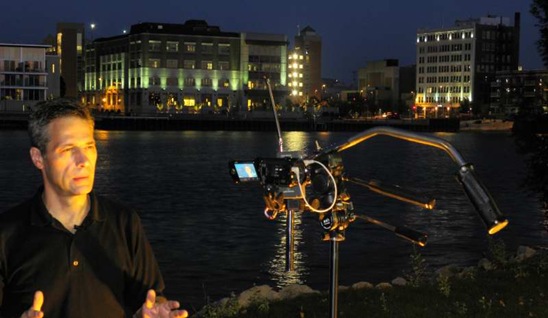
In today’s digital flow of information, news and images, getting a story out in Video for WFRV promo 1 Still (9)_757Video for WFRV promo 1 Still (9)compressedalmost real time isn’t only for the big guys any longer.   With tapeless workflow, small efficient High Definition cameras and all digital non linear editing systems available now to even basic consumers, it is quickly becoming all about workflow and efficiency. 

Those with an already established workflow and a proven and efficient method of distribution will win.  He who gets the story out first … wins.

Now with today’s even most basic non linear editing systems … it is possible to quickly render one to two minute reports in full … crystal clear High Definition, with rapid online worldwide distribution available in multiple formats and resolutions depending on the ability of the consumer’s hardware and their personal preferences.

For those who embrace this new forum to distribute quality information, news, and video will have an advantage over the others in cost as well as quality.The ability to provide content to independent as well as network distributors with very little in investment or overhead costs for the distributor … in a rapid digital format that can keep pace with today’s continuous rapid flow of events as they occur.

With the internet infrastructure improving and bandwidth expanding the demand for quality High Definition content is increasing every day. 

By using the Opaque business model and working directly with your field crews, we can provide you with a low cost method of delivering High Definition online video content.

Creating this high quality content at a cost and pace never before seen … providing our viewers with the highest quality content in the shortest amount of time … Getting the story out first … with the technology of today … and the vision for tomorrow

If you would like to download this video, here are your options ….Quicktime H.264 720p version, (54.3MB, click here to download).  If that file is to much for your video processor on your office computer, you can try the HD Light version (23.5MB, click here to download).
In Windows Media format, 720p HD version (86.2MB,
click here to download),  1080i version (MB, click here to download).


Wednesday, September 15, 2010

Trapped in Southern Bellevue … Road Construction Woes

Bellevue Rd Const Sept 16 2010 top shot If anyone has recently tried to get around in eastern Bellevue recently, one may have easily become frustrated. With many (in our case mohttp://villageofbellevue.org/images/stories/images/Public_Works/2010Main_Verlin_Manitowoc/Stage_2_Detour.pngst) of the throughways blocked by construction, Verlin Rd and Main Street 54311it has been both an expensive (in gas) and time consuming endeavor in making ones way to any destination other than directly out of town.  

At least with Stage 1 of the construction projectBellevue Rd Const Sept 16 2010 (7) completed, including the addition of a new round a bout at Verlin Rd (Co. JJ) and Main Street (Hwy 141), it helps somewhat. 

Now to Stage 2. 

Phase 2 of Manitowoc Road Project Begins Monday, September 13th as described on thBellevue Rd Const Sept 16 2010 (14) e http://villageofbellevue.blogspot.com/ blog with more information on the town’s website,http://villageofbellevue.org/. 

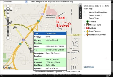
One may derive from the stage 2 detour map that only one direction may be available.  It almost felt as if we were trapped here for a good part of the summer. We should not have been surprised when trying road construction map from googel Bellevue Sept 15 2010to get on to I43, a route SE in to Mason St via Ontario Rd.  Not so much.  One will find that just to the north of Ontario Rd/Eaton Rd Round A Bout, Ontario Road is closed and blocked as well.  One does not seemBellevue Rd Const Sept 16 2010 (31) to discover this until there.  At the blockage. This fill force one to take a detour …  from the detour, thus adding more time to the overall trip and miss ones appointment.  On the map to the right I, I show the approximate location of whereBellevue Rd Const Sept 16 2010 (33) Ontario Rd is blocked.

The Village of Bellevue Blog statesProject Status; Construction has started on the 2nd phase o f  the project.  With this phase the bridge between the ramps over I-43 will be closed to traffic during construction.  In addition, night ramp closures will also occur.  The first closures will be September 14th, 15th, and 16th from 7:00 PM to 9:00 AM.  This closure will impact the NB I-43 Ramp to Manitowoc Road.  The second set of closures will impact the SB I-43 On & Off Ramps and will occur on September 21st, 22nd, & 23rd.  These dates and times subject to change based on weather.  All construction must be completed by November 23, 2010”. 

The
Village of Bellevue Website states in their Stage 2 Overview
The second stage of the project  will be to complete the work needed on the bridge and ramps over I-43. It is anticipated that the bridge will be closed to all traffic for a maximum of 15 working days. During this time the bridge concrete will be repaired and resurfaced. The ramps would remain open except when temporary closures take place for repairs and improvements on those ramps.  Construction will be allowed at night to expedite the construction. Ramps may be closed at night from 7 pm to 9 am, but reopen during the day. All lanes of traffic along CTH JJ between the ramp and Eaton as well as the ramp and Main Street will remain open to traffic”.

Let us all hope that the remainder of the work goes well and is finished on time. I am depending on it, and so is my gas budget.